


Aout032023BisPP

FPortier
User

Length
5.3 km

Max alt
259 m

Uphill gradient
116 m
Km-Effort
6.9 km

Min alt
183 m

Downhill gradient
118 m
Boucle
Yes
Creation date :
2023-08-01 16:08:12.57
Updated on :
2023-08-01 16:08:52.157
1h33
Difficulty : Medium

FREE GPS app for hiking
 SityTrail
IGN / Geographical institutes
SityTrail Plus
The world is yours!
About
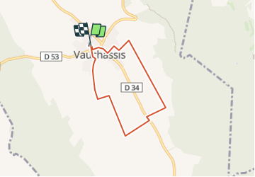
Trail Walking of 5.3 km to be discovered at Grand Est, Aube, Vauchassis. This trail is proposed by FPortier.
Positioning
Country:
France
Region :
Grand Est
Department/Province :
Aube
Municipality :
Vauchassis
Location:
Unknown
Start:(Dec)
Start:(UTM)
568453 ; 5341425 (31U) N.
Comments