


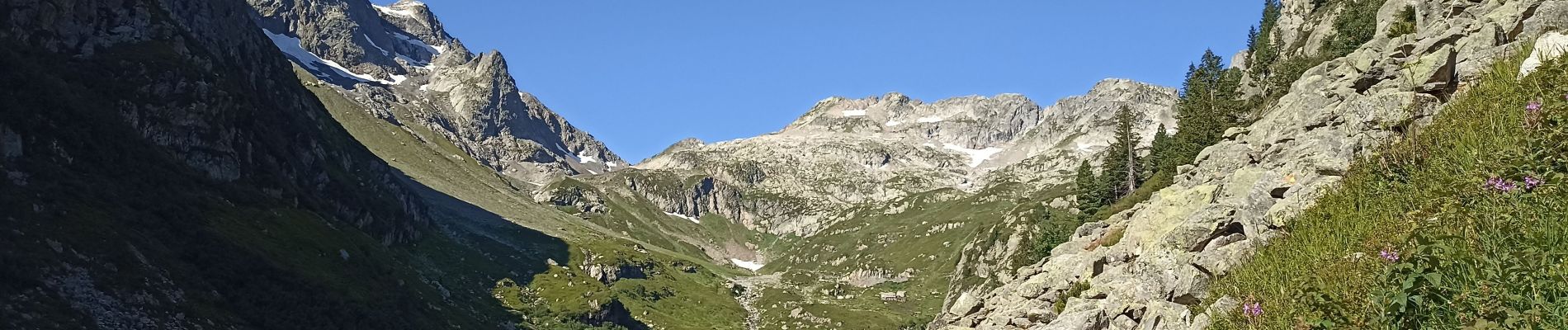
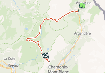
du village du Buet jusqu'à Planpraz

jeff2
User

Length
25 km

Max alt
2528 m

Uphill gradient
2319 m
Km-Effort
53 km

Min alt
1344 m

Downhill gradient
1615 m
Boucle
No
Creation date :
2023-07-31 05:57:47.653
Updated on :
2023-08-01 16:18:00.439
33h24
Difficulty : Difficult

FREE GPS app for hiking
 SityTrail
IGN / Geographical institutes
SityTrail Plus
The world is yours!
About
Trail Walking of 25 km to be discovered at Auvergne-Rhône-Alpes, Upper Savoy, Vallorcine. This trail is proposed by jeff2.
Description
Longue et pas, mal de D
Photos


Positioning
Country:
France
Region :
Auvergne-Rhône-Alpes
Department/Province :
Upper Savoy
Municipality :
Vallorcine
Location:
Unknown
Start:(Dec)
Start:(UTM)
339003 ; 5098250 (32T) N.
Comments