


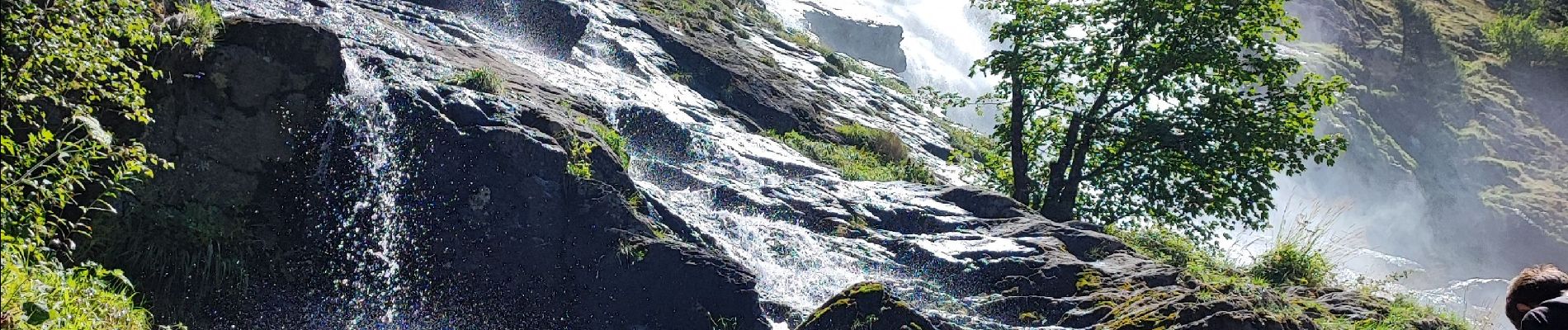
Oz en Oisans Cascade de La Fare

kephas
User

Length
27 km

Max alt
3301 m

Uphill gradient
3697 m
Km-Effort
77 km

Min alt
1126 m

Downhill gradient
3687 m
Boucle
Yes
Creation date :
2023-08-03 07:05:23.371
Updated on :
2023-08-03 14:15:03.167
7h08
Difficulty : Medium

FREE GPS app for hiking
 SityTrail
IGN / Geographical institutes
SityTrail Plus
The world is yours!
About
Trail Walking of 27 km to be discovered at Auvergne-Rhône-Alpes, Isère, Oz. This trail is proposed by kephas.
Description
Balade à la journée
Photos


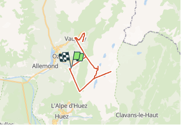
Positioning
Country:
France
Region :
Auvergne-Rhône-Alpes
Department/Province :
Isère
Municipality :
Oz
Location:
Unknown
Start:(Dec)
Start:(UTM)
269855 ; 5001441 (32T) N.
Comments