


la vallée de la claree

Sorriaux
User

Length
7.9 km

Max alt
2464 m

Uphill gradient
451 m
Km-Effort
13.9 km

Min alt
2025 m

Downhill gradient
449 m
Boucle
Yes
Creation date :
2021-06-25 07:32:37.371
Updated on :
2023-08-04 11:49:09.697
3h13
Difficulty : Medium

FREE GPS app for hiking
 SityTrail
IGN / Geographical institutes
SityTrail Plus
The world is yours!
About
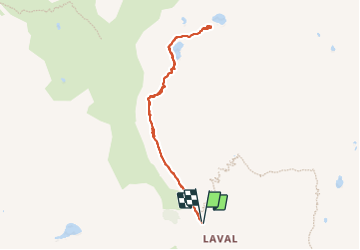
Trail Walking of 7.9 km to be discovered at Provence-Alpes-Côte d'Azur, Hautes-Alpes, Névache. This trail is proposed by Sorriaux.
Description
magnifique
Positioning
Country:
France
Region :
Provence-Alpes-Côte d'Azur
Department/Province :
Hautes-Alpes
Municipality :
Névache
Location:
Unknown
Start:(Dec)
Start:(UTM)
305167 ; 4992543 (32T) N.
Comments