


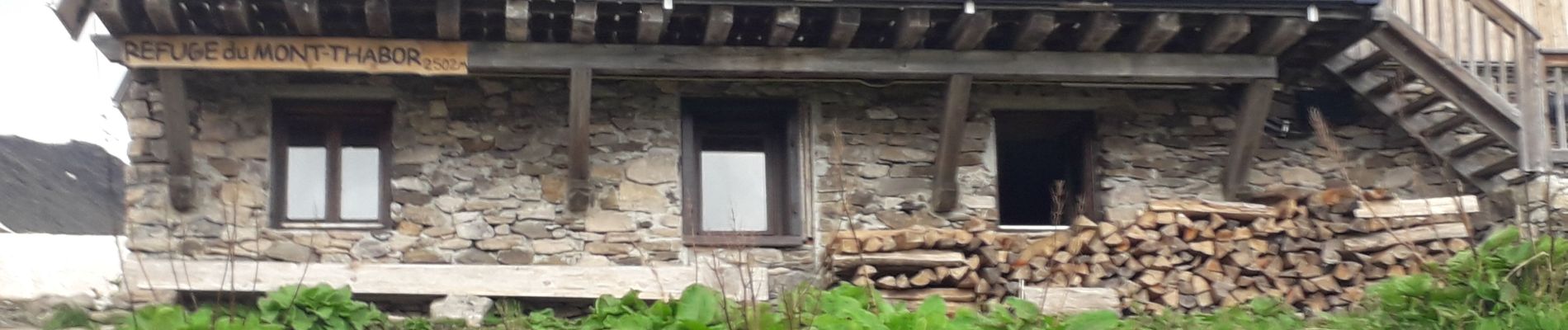
Vallée étroite refuge du Thabor

Sorriaux
User
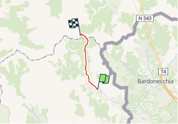

Length
10.2 km

Max alt
2523 m

Uphill gradient
798 m
Km-Effort
18.4 km

Min alt
1760 m

Downhill gradient
79 m
Boucle
No
Creation date :
2021-07-07 06:29:08.521
Updated on :
2023-08-04 11:49:12.208
3h06
Difficulty : Difficult

FREE GPS app for hiking
 SityTrail
IGN / Geographical institutes
SityTrail Plus
The world is yours!
About
Trail Walking of 10.2 km to be discovered at Provence-Alpes-Côte d'Azur, Hautes-Alpes, Névache. This trail is proposed by Sorriaux.
Description
le tour du Thabor 2 jours
Photos


Positioning
Country:
France
Region :
Provence-Alpes-Côte d'Azur
Department/Province :
Hautes-Alpes
Municipality :
Névache
Location:
Unknown
Start:(Dec)
Start:(UTM)
312888 ; 4993430 (32T) N.
Comments