


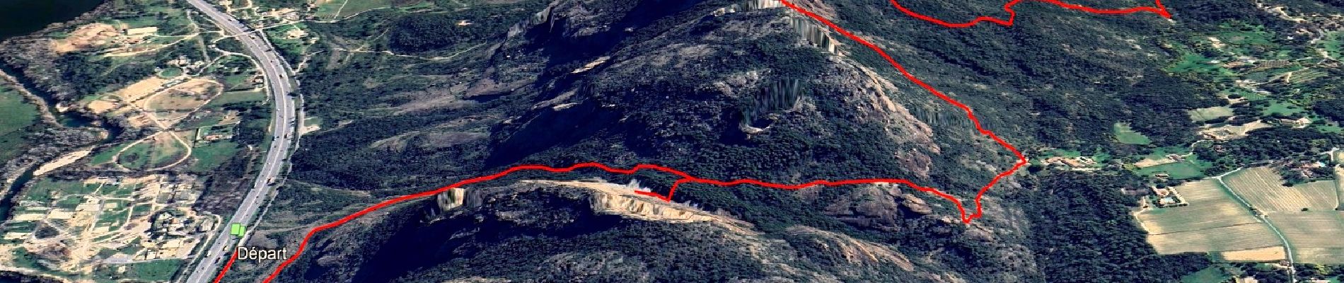
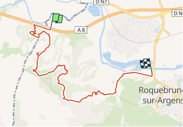
Tour du rocher de Roquebrune

affinetataille
User GUIDE

Length
9.1 km

Max alt
340 m

Uphill gradient
465 m
Km-Effort
15.4 km

Min alt
10 m

Downhill gradient
476 m
Boucle
No
Creation date :
2023-08-05 23:51:42.19
Updated on :
2025-06-13 13:37:24.392
6h00
Difficulty : Difficult

FREE GPS app for hiking
 SityTrail
IGN / Geographical institutes
SityTrail Plus
The world is yours!
About
Trail Walking of 9.1 km to be discovered at Provence-Alpes-Côte d'Azur, Var, Roquebrune-sur-Argens. This trail is proposed by affinetataille.
Photos


28 photos in total. Please click on a photo to see them all in the gallery.
Positioning
Country:
France
Region :
Provence-Alpes-Côte d'Azur
Department/Province :
Var
Municipality :
Roquebrune-sur-Argens
Location:
Unknown
Start:(Dec)
Start:(UTM)
305685 ; 4814635 (32T) N.
Comments