


la Balme Riendre

cousam
User
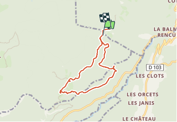

Length
7.1 km

Max alt
1117 m

Uphill gradient
322 m
Km-Effort
11.4 km

Min alt
837 m

Downhill gradient
336 m
Boucle
No
Creation date :
2023-08-06 08:19:38.764
Updated on :
2023-08-06 15:33:15.903
2h05
Difficulty : Medium

FREE GPS app for hiking
 SityTrail
IGN / Geographical institutes
SityTrail Plus
The world is yours!
About
Trail Walking of 7.1 km to be discovered at Auvergne-Rhône-Alpes, Isère, Presles. This trail is proposed by cousam.
Description
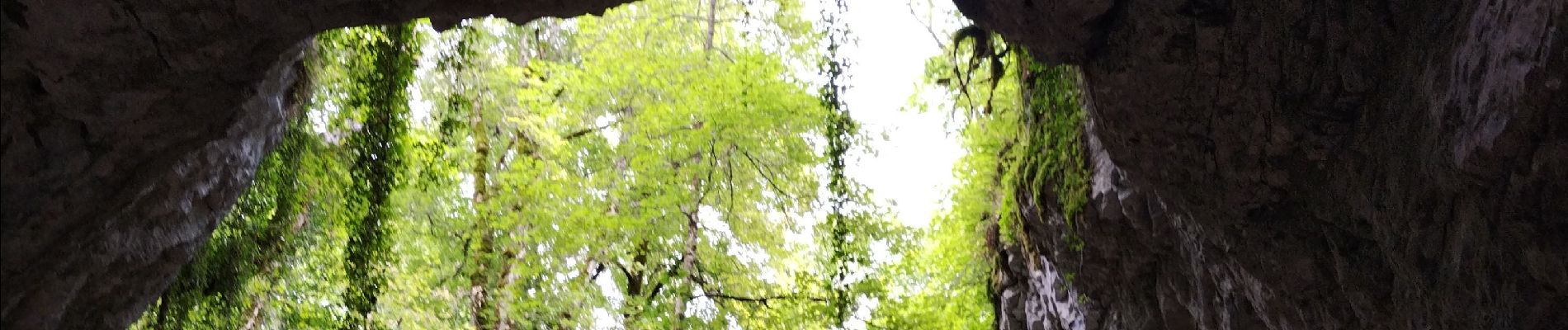
La cheminée des rochers du Ranc par la Balme du Riendre.
Entre les KM 2,5 et 3 sente pas très visible.
La cheminée des rochers du Ranc passage avec corde.
Photos


Positioning
Country:
France
Region :
Auvergne-Rhône-Alpes
Department/Province :
Isère
Municipality :
Presles
Location:
Unknown
Start:(Dec)
Start:(UTM)
692291 ; 4995518 (31T) N.
Comments