


saint heant

chrispaquet
User
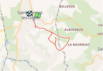

Length
6.4 km

Max alt
566 m

Uphill gradient
129 m
Km-Effort
8.1 km

Min alt
477 m

Downhill gradient
122 m
Boucle
Yes
Creation date :
2023-08-06 12:11:58.115
Updated on :
2023-08-06 14:01:06.694
1h48
Difficulty : Medium

FREE GPS app for hiking
 SityTrail
IGN / Geographical institutes
SityTrail Plus
The world is yours!
About
Trail Walking of 6.4 km to be discovered at Auvergne-Rhône-Alpes, Loire, Saint-Bonnet-les-Oules. This trail is proposed by chrispaquet.
Positioning
Country:
France
Region :
Auvergne-Rhône-Alpes
Department/Province :
Loire
Municipality :
Saint-Bonnet-les-Oules
Location:
Unknown
Start:(Dec)
Start:(UTM)
603843 ; 5043930 (31T) N.
Comments