


Cogolin - Cavalaire - La Molle

J2P
User
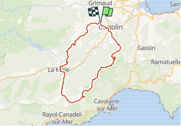

Length
30 km

Max alt
470 m

Uphill gradient
762 m
Km-Effort
41 km

Min alt
8 m

Downhill gradient
758 m
Boucle
Yes
Creation date :
2023-08-09 07:02:59.0
Updated on :
2023-08-09 10:41:49.348
2h48
Difficulty : Difficult

FREE GPS app for hiking
 SityTrail
IGN / Geographical institutes
SityTrail Plus
The world is yours!
About
Trail Mountain bike of 30 km to be discovered at Provence-Alpes-Côte d'Azur, Var, Cogolin. This trail is proposed by J2P.
Description
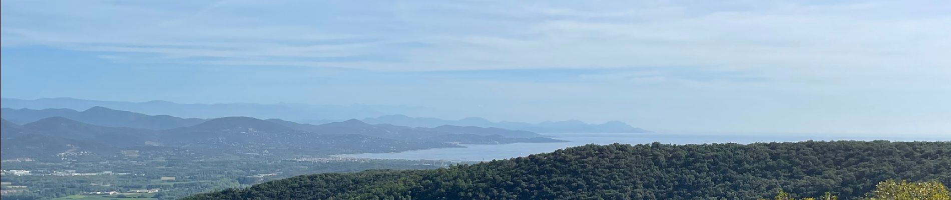
Très beau tour avec une vue magnifique sur les îles
Photos


Positioning
Country:
France
Region :
Provence-Alpes-Côte d'Azur
Department/Province :
Var
Municipality :
Cogolin
Location:
Unknown
Start:(Dec)
Start:(UTM)
298927 ; 4791938 (32T) N.
Comments