


compiegne buissonnet

Pachinou
User

Length
8.5 km

Max alt
62 m

Uphill gradient
71 m
Km-Effort
9.4 km

Min alt
36 m

Downhill gradient
76 m
Boucle
Yes
Creation date :
2023-08-09 11:59:21.064
Updated on :
2023-08-09 14:43:13.728
2h43
Difficulty : Medium

FREE GPS app for hiking
 SityTrail
IGN / Geographical institutes
SityTrail Plus
The world is yours!
About
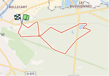
Trail Walking of 8.5 km to be discovered at Hauts-de-France, Oise, Compiègne. This trail is proposed by Pachinou.
Positioning
Country:
France
Region :
Hauts-de-France
Department/Province :
Oise
Municipality :
Compiègne
Location:
Unknown
Start:(Dec)
Start:(UTM)
488658 ; 5474330 (31U) N.
Comments