


rando du vendredi

sdroneau
User
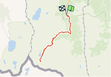

Length
17 km

Max alt
2343 m

Uphill gradient
977 m
Km-Effort
30 km

Min alt
1476 m

Downhill gradient
976 m
Boucle
Yes
Creation date :
2023-07-28 06:47:44.438
Updated on :
2023-08-10 07:42:57.937
6h00
Difficulty : Very difficult

FREE GPS app for hiking
 SityTrail
IGN / Geographical institutes
SityTrail Plus
The world is yours!
About
Trail Walking of 17 km to be discovered at Occitania, Hautespyrenees, Arrens-Marsous. This trail is proposed by sdroneau.
Positioning
Country:
France
Region :
Occitania
Department/Province :
Hautespyrenees
Municipality :
Arrens-Marsous
Location:
Unknown
Start:(Dec)
Start:(UTM)
722891 ; 4751454 (30T) N.
Comments