


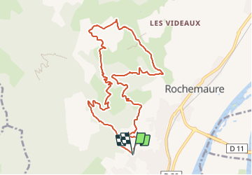
Le Chenavary 11km.

chancha
User GUIDE

Length
11 km

Max alt
491 m

Uphill gradient
475 m
Km-Effort
17.3 km

Min alt
158 m

Downhill gradient
475 m
Boucle
Yes
Creation date :
2023-08-10 08:23:14.842
Updated on :
2023-08-20 10:47:41.422
3h56
Difficulty : Difficult

FREE GPS app for hiking
 SityTrail
IGN / Geographical institutes
SityTrail Plus
The world is yours!
About
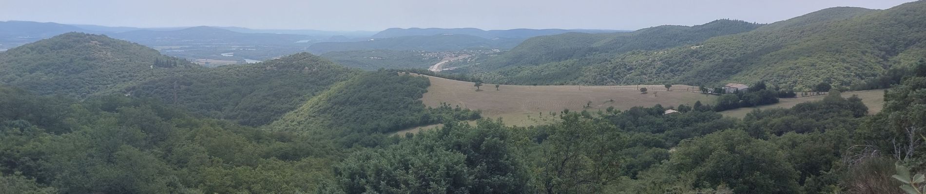
Trail Walking of 11 km to be discovered at Auvergne-Rhône-Alpes, Ardèche, Rochemaure. This trail is proposed by chancha.
Description
Vers le 3eme km le petit chemin a gauche après le virage n'est plus praticable il faut continuer plus bas et passer presque dans la propriété et récupérer le sentier sur la gauche .
Photos


Positioning
Country:
France
Region :
Auvergne-Rhône-Alpes
Department/Province :
Ardèche
Municipality :
Rochemaure
Location:
Unknown
Start:(Dec)
Start:(UTM)
634055 ; 4937216 (31T) N.
Comments