


Simon Quentin hts pltx

aldaus
User
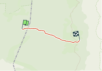

Length
3.3 km

Max alt
1630 m

Uphill gradient
132 m
Km-Effort
4.7 km

Min alt
1518 m

Downhill gradient
25 m
Boucle
No
Creation date :
2023-08-08 15:14:16.239
Updated on :
2023-08-11 15:58:03.92
1h17
Difficulty : Easy

FREE GPS app for hiking
 SityTrail
IGN / Geographical institutes
SityTrail Plus
The world is yours!
About
Trail Walking of 3.3 km to be discovered at Auvergne-Rhône-Alpes, Drôme, Saint-Agnan-en-Vercors. This trail is proposed by aldaus.
Positioning
Country:
France
Region :
Auvergne-Rhône-Alpes
Department/Province :
Drôme
Municipality :
Saint-Agnan-en-Vercors
Location:
Unknown
Start:(Dec)
Start:(UTM)
695460 ; 4974166 (31T) N.
Comments