


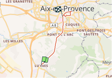
Aix en Provence Luynes-Centre ville (bus)

MAUVAGE Patrick
User

Length
7.7 km

Max alt
207 m

Uphill gradient
143 m
Km-Effort
9.5 km

Min alt
131 m

Downhill gradient
104 m
Boucle
No
Creation date :
2023-08-12 08:07:28.0
Updated on :
2023-08-16 09:52:04.437
2h09
Difficulty : Medium

FREE GPS app for hiking
 SityTrail
IGN / Geographical institutes
SityTrail Plus
The world is yours!
About
Trail Walking of 7.7 km to be discovered at Provence-Alpes-Côte d'Azur, Bouches-du-Rhône, Aix-en-Provence. This trail is proposed by MAUVAGE Patrick.
Positioning
Country:
France
Region :
Provence-Alpes-Côte d'Azur
Department/Province :
Bouches-du-Rhône
Municipality :
Aix-en-Provence
Location:
Unknown
Start:(Dec)
Start:(UTM)
695545 ; 4817321 (31T) N.
Comments