


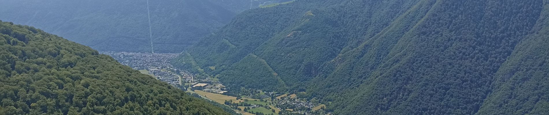
le pont de cazaux

ra2000
User
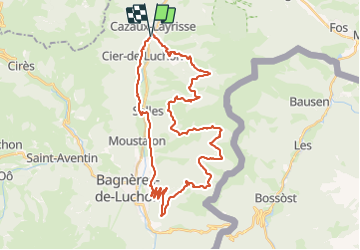

Length
43 km

Max alt
1533 m

Uphill gradient
1696 m
Km-Effort
65 km

Min alt
587 m

Downhill gradient
1699 m
Boucle
Yes
Creation date :
2023-07-22 07:33:54.237
Updated on :
2023-08-12 19:44:06.194
6h11
Difficulty : Difficult

FREE GPS app for hiking
 SityTrail
IGN / Geographical institutes
SityTrail Plus
The world is yours!
About
Trail Electric bike of 43 km to be discovered at Occitania, Haute-Garonne, Cazaux-Layrisse. This trail is proposed by ra2000.
Photos

Positioning
Country:
France
Region :
Occitania
Department/Province :
Haute-Garonne
Municipality :
Cazaux-Layrisse
Location:
Unknown
Start:(Dec)
Start:(UTM)
304553 ; 4748920 (31T) N.
Comments