


route forestière de la Traverse/Mélezen

andre06130
User
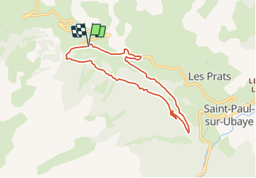

Length
7.6 km

Max alt
1761 m

Uphill gradient
245 m
Km-Effort
10.8 km

Min alt
1580 m

Downhill gradient
239 m
Boucle
Yes
Creation date :
2023-08-13 07:12:20.333
Updated on :
2023-08-14 10:06:57.458
2h27
Difficulty : Medium
45m
Difficulty : Easy
--
Difficulty : Easy

FREE GPS app for hiking
 SityTrail
IGN / Geographical institutes
SityTrail Plus
The world is yours!
About
Trail Walking of 7.6 km to be discovered at Provence-Alpes-Côte d'Azur, Alpes-de-Haute-Provence, Saint-Paul-sur-Ubaye. This trail is proposed by andre06130.
Description
Parcour dans les bois sauf 1.2 km sur la route
Positioning
Country:
France
Region :
Provence-Alpes-Côte d'Azur
Department/Province :
Alpes-de-Haute-Provence
Municipality :
Saint-Paul-sur-Ubaye
Location:
Unknown
Start:(Dec)
Start:(UTM)
318608 ; 4932921 (32T) N.
Comments