


autour de gérardmer

Maca8284
User
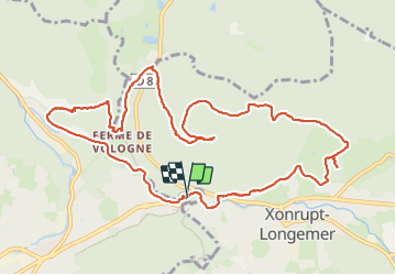

Length
12.6 km

Max alt
975 m

Uphill gradient
457 m
Km-Effort
18.7 km

Min alt
629 m

Downhill gradient
456 m
Boucle
Yes
Creation date :
2023-08-13 07:23:20.888
Updated on :
2023-10-03 15:22:38.694
3h51
Difficulty : Very difficult

FREE GPS app for hiking
 SityTrail
IGN / Geographical institutes
SityTrail Plus
The world is yours!
About
Trail Walking of 12.6 km to be discovered at Grand Est, Vosges, Gérardmer. This trail is proposed by Maca8284.
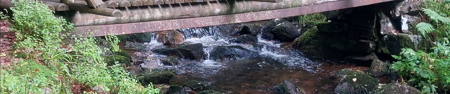
Photos


Positioning
Country:
France
Region :
Grand Est
Department/Province :
Vosges
Municipality :
Gérardmer
Location:
Unknown
Start:(Dec)
Start:(UTM)
344309 ; 5327744 (32U) N.
Comments