


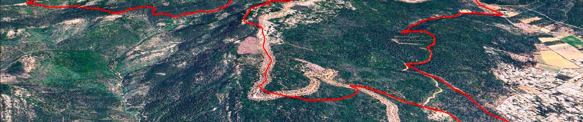
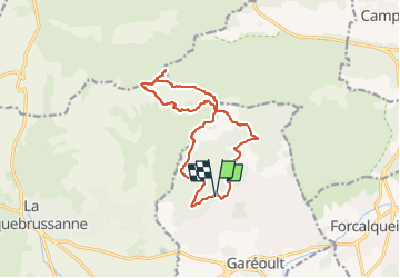
L'Amarron depuis Garéoult

affinetataille
User GUIDE

Length
14.4 km

Max alt
769 m

Uphill gradient
601 m
Km-Effort
22 km

Min alt
392 m

Downhill gradient
606 m
Boucle
Yes
Creation date :
2023-08-13 12:36:41.929
Updated on :
2024-03-04 08:55:50.667
6h00
Difficulty : Medium

FREE GPS app for hiking
 SityTrail
IGN / Geographical institutes
SityTrail Plus
The world is yours!
About
Trail Walking of 14.4 km to be discovered at Provence-Alpes-Côte d'Azur, Var, Garéoult. This trail is proposed by affinetataille.
Photos


Positioning
Country:
France
Region :
Provence-Alpes-Côte d'Azur
Department/Province :
Var
Municipality :
Garéoult
Location:
Unknown
Start:(Dec)
Start:(UTM)
259547 ; 4803355 (32T) N.
Comments