


Lens

VANDERPUTTENMi
User GUIDE
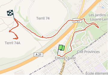

Length
2.5 km

Max alt
160 m

Uphill gradient
87 m
Km-Effort
3.5 km

Min alt
68 m

Downhill gradient
45 m
Boucle
No
Creation date :
2023-08-14 13:46:21.338
Updated on :
2023-08-14 15:37:42.893
1h51
Difficulty : Easy

FREE GPS app for hiking
 SityTrail
IGN / Geographical institutes
SityTrail Plus
The world is yours!
About
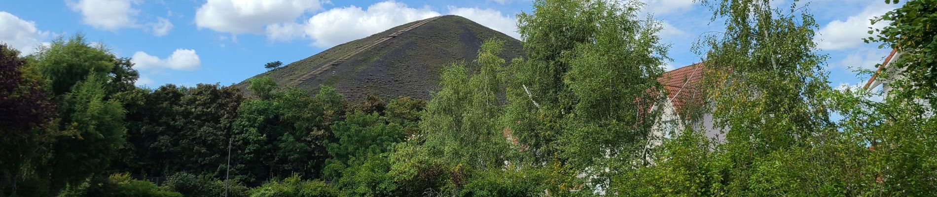
Trail Walking of 2.5 km to be discovered at Hauts-de-France, Pas-de-Calais, Loos-en-Gohelle. This trail is proposed by VANDERPUTTENMi.
Photos

Positioning
Country:
France
Region :
Hauts-de-France
Department/Province :
Pas-de-Calais
Municipality :
Loos-en-Gohelle
Location:
Unknown
Start:(Dec)
Start:(UTM)
484707 ; 5587782 (31U) N.
Comments