


Marche

jackcox
User
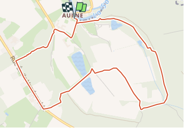

Length
5.7 km

Max alt
191 m

Uphill gradient
127 m
Km-Effort
7.4 km

Min alt
111 m

Downhill gradient
127 m
Boucle
Yes
Creation date :
2023-08-14 17:05:44.892
Updated on :
2023-08-14 17:07:21.188
1h40
Difficulty : Medium

FREE GPS app for hiking
 SityTrail
IGN / Geographical institutes
SityTrail Plus
The world is yours!
About
Trail Walking of 5.7 km to be discovered at Wallonia, Hainaut, Thuin. This trail is proposed by jackcox.
Positioning
Country:
Belgium
Region :
Wallonia
Department/Province :
Hainaut
Municipality :
Thuin
Location:
Unknown
Start:(Dec)
Start:(UTM)
594788 ; 5580214 (31U) N.
Comments