La rando des 6 lacs
Camping Les Rives du Lac
Les Hautes Alpes à découvrir ! GUIDE+
Length
6 km
Max alt
2695 m
Uphill gradient
134 m
Km-Effort
8.9 km
Min alt
2284 m
Downhill gradient
470 m
Boucle
No
Creation date :
2023-08-15 09:57:33.088
Updated on :
2023-08-15 09:59:30.09
2h02
Difficulty : Medium
FREE GPS app for hiking
About
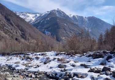
Trail Walking of 6 km to be discovered at Provence-Alpes-Côte d'Azur, Hautes-Alpes, Orcières. This trail is proposed by Camping Les Rives du Lac.
Description
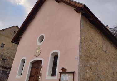
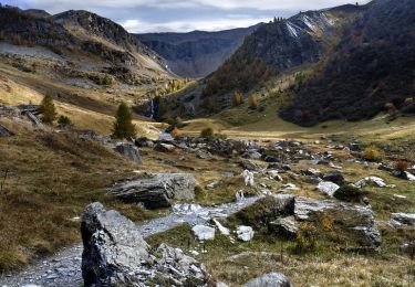
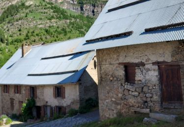
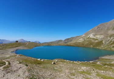
Au depart Drouvet, une rando très facile qui rejoint Rocherousse.
Positioning
Country:
France
Region :
Provence-Alpes-Côte d'Azur
Department/Province :
Hautes-Alpes
Municipality :
Orcières
Location:
Unknown
Start:(Dec)
Start:(UTM)
287620 ; 4955460 (32T) N.
Comments
Trails nearby
Le Forest des marches
Walking
Easy
(2)
Orcières,
Provence-Alpes-Côte d'Azur,
Hautes-Alpes,
France
6.3 km | 9.9 km-effort
1h 42min
Yes
R45 Marmottes a Prapic
Walking
Medium
(2)
Orcières,
Provence-Alpes-Côte d'Azur,
Hautes-Alpes,
France
9 km | 14 km-effort
2h 57min
Yes
Orcieres (Hautes Alpes)
Walking
Very difficult
(1)
Orcières,
Provence-Alpes-Côte d'Azur,
Hautes-Alpes,
France
12 km | 19.4 km-effort
4h 24min
Yes
Roc Diolon par le col de Fressinieres 11/08/23
Walking
Very difficult
Orcières,
Provence-Alpes-Côte d'Azur,
Hautes-Alpes,
France
16.3 km | 32 km-effort
7h 21min
Yes
Balade Vallée Champoléon
Walking
Easy
Champoléon,
Provence-Alpes-Côte d'Azur,
Hautes-Alpes,
France
9.5 km | 12.2 km-effort
2h 40min
Yes
Col des Tourettes - Croix Lorraine 08/09/18
Walking
Difficult
Orcières,
Provence-Alpes-Côte d'Azur,
Hautes-Alpes,
France
21 km | 37 km-effort
5h 30min
Yes
Prapic Basset Cabane de la Barre
Walking
Medium
(1)
Orcières,
Provence-Alpes-Côte d'Azur,
Hautes-Alpes,
France
17.6 km | 30 km-effort
6h 10min
Yes
08072013
Walking
Medium
(1)
Orcières,
Provence-Alpes-Côte d'Azur,
Hautes-Alpes,
France
10.5 km | 17.9 km-effort
2h 36min
Yes
Merlette Les Lacs
Walking
Easy
(1)
Orcières,
Provence-Alpes-Côte d'Azur,
Hautes-Alpes,
France
18.4 km | 32 km-effort
4h 39min
Yes