


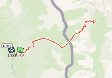
L'Echalp au refuge Jervis par le col Lacroix

CSMSRANDOS
User

Length
11.2 km

Max alt
2312 m

Uphill gradient
1161 m
Km-Effort
27 km

Min alt
1709 m

Downhill gradient
1161 m
Boucle
Yes
Creation date :
2023-08-16 08:48:07.452
Updated on :
2023-08-16 12:00:45.337
6h03
Difficulty : Very difficult

FREE GPS app for hiking
 SityTrail
IGN / Geographical institutes
SityTrail Plus
The world is yours!
About
Trail Walking of 11.2 km to be discovered at Provence-Alpes-Côte d'Azur, Hautes-Alpes, Abriès-Ristolas. This trail is proposed by CSMSRANDOS.
Description
Départ de l'Echalp jusqu’au col La Croix.
Descente jusqu’au refuge Jervis ( bon repas italien)
Puis retour par le même chemin.
Positioning
Country:
France
Region :
Provence-Alpes-Côte d'Azur
Department/Province :
Hautes-Alpes
Municipality :
Abriès-Ristolas
Location:
Ristolas
Start:(Dec)
Start:(UTM)
341216 ; 4958121 (32T) N.
Comments