st_breithorn

My Switzerland
Optez pour le retour à la nature GUIDE+
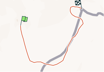

Length
3.4 km

Max alt
4140 m

Uphill gradient
358 m
Km-Effort
7.1 km

Min alt
3783 m

Downhill gradient
24 m
Boucle
No
Creation date :
2014-12-10 00:00:00.0
Updated on :
2014-12-10 00:00:00.0
1h41
Difficulty : Unknown

FREE GPS app for hiking
 SityTrail
IGN / Geographical institutes
SityTrail Plus
The world is yours!
About
Trail Other activity of 3.4 km to be discovered at Valais/Wallis, Visp, Zermatt. This trail is proposed by My Switzerland.
Positioning
Country:
Switzerland
Region :
Valais/Wallis
Department/Province :
Visp
Municipality :
Zermatt
Location:
Unknown
Start:(Dec)
Start:(UTM)
401535 ; 5087869 (32T) N.
Comments