


boucle plomb du cantal du col de prat de bouc

fab0202
User
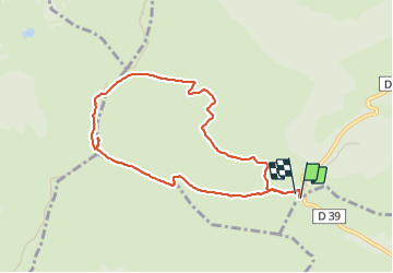

Length
8.3 km

Max alt
1835 m

Uphill gradient
449 m
Km-Effort
14.3 km

Min alt
1382 m

Downhill gradient
450 m
Boucle
Yes
Creation date :
2023-08-17 07:35:33.298
Updated on :
2023-08-17 11:04:04.909
3h13
Difficulty : Medium

FREE GPS app for hiking
 SityTrail
IGN / Geographical institutes
SityTrail Plus
The world is yours!
About
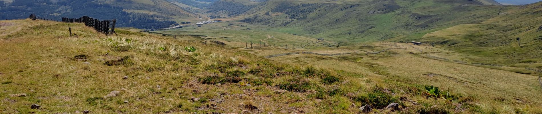
Trail Walking of 8.3 km to be discovered at Auvergne-Rhône-Alpes, Cantal, Albepierre-Bredons. This trail is proposed by fab0202.
Description
belle rando avec un super panorama sur la chaîne des puys.
Photos


Positioning
Country:
France
Region :
Auvergne-Rhône-Alpes
Department/Province :
Cantal
Municipality :
Albepierre-Bredons
Location:
Unknown
Start:(Dec)
Start:(UTM)
483732 ; 4988783 (31T) N.
Comments