


Muzelle

Liebeaux
User
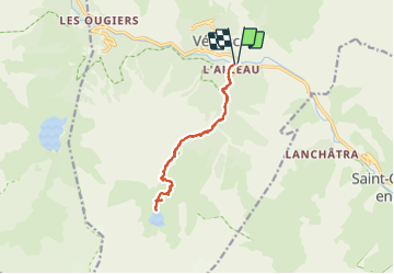

Length
14.1 km

Max alt
2200 m

Uphill gradient
1271 m
Km-Effort
31 km

Min alt
940 m

Downhill gradient
1273 m
Boucle
Yes
Creation date :
2023-08-17 06:46:20.604
Updated on :
2023-08-17 15:23:40.635
8h36
Difficulty : Very difficult

FREE GPS app for hiking
 SityTrail
IGN / Geographical institutes
SityTrail Plus
The world is yours!
About
Trail Walking of 14.1 km to be discovered at Auvergne-Rhône-Alpes, Isère, Les Deux Alpes. This trail is proposed by Liebeaux.
Positioning
Country:
France
Region :
Auvergne-Rhône-Alpes
Department/Province :
Isère
Municipality :
Les Deux Alpes
Location:
Vénosc
Start:(Dec)
Start:(UTM)
273188 ; 4985312 (32T) N.
Comments