


laparan etang de fontargente

ego
User
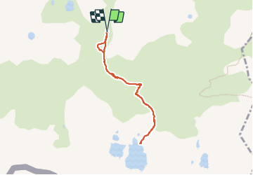

Length
7 km

Max alt
2149 m

Uphill gradient
458 m
Km-Effort
13.1 km

Min alt
1695 m

Downhill gradient
455 m
Boucle
Yes
Creation date :
2023-07-28 09:16:42.365
Updated on :
2023-08-17 16:13:19.672
3h22
Difficulty : Difficult

FREE GPS app for hiking
 SityTrail
IGN / Geographical institutes
SityTrail Plus
The world is yours!
About
Trail Walking of 7 km to be discovered at Occitania, Ariège, Aston. This trail is proposed by ego .
Positioning
Country:
France
Region :
Occitania
Department/Province :
Ariège
Municipality :
Aston
Location:
Unknown
Start:(Dec)
Start:(UTM)
393716 ; 4722710 (31T) N.
Comments