


Lavaldens 400 +

claude nier
User
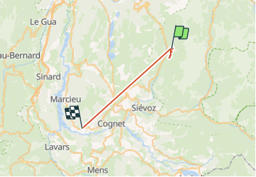

Length
23 km

Max alt
1768 m

Uphill gradient
1947 m
Km-Effort
51 km

Min alt
685 m

Downhill gradient
2471 m
Boucle
No
Creation date :
2023-08-17 06:15:35.695
Updated on :
2023-08-17 18:02:09.935
2h25
Difficulty : Very difficult

FREE GPS app for hiking
 SityTrail
IGN / Geographical institutes
SityTrail Plus
The world is yours!
About
Trail Walking of 23 km to be discovered at Auvergne-Rhône-Alpes, Isère, Lavaldens. This trail is proposed by claude nier.
Description
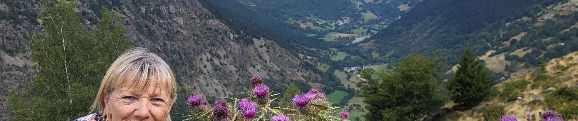
A la recherche de myrtilles !!!
Photos


Positioning
Country:
France
Region :
Auvergne-Rhône-Alpes
Department/Province :
Isère
Municipality :
Lavaldens
Location:
Unknown
Start:(Dec)
Start:(UTM)
728265 ; 4985216 (31T) N.
Comments