


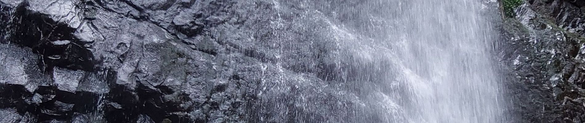
LES CASCADES DU SAUT DU LOUP, ROSSIGNOLET ET QUEUREUILH

walrou63
User
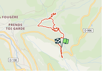

Length
4.4 km

Max alt
1211 m

Uphill gradient
187 m
Km-Effort
7 km

Min alt
1035 m

Downhill gradient
194 m
Boucle
Yes
Creation date :
2023-08-18 08:20:38.848
Updated on :
2023-08-18 10:47:07.231
1h13
Difficulty : Medium

FREE GPS app for hiking
 SityTrail
IGN / Geographical institutes
SityTrail Plus
The world is yours!
About
Trail Walking of 4.4 km to be discovered at Auvergne-Rhône-Alpes, Puy-de-Dôme, Mont-Dore. This trail is proposed by walrou63.
Photos


Positioning
Country:
France
Region :
Auvergne-Rhône-Alpes
Department/Province :
Puy-de-Dôme
Municipality :
Mont-Dore
Location:
Unknown
Start:(Dec)
Start:(UTM)
485672 ; 5047824 (31T) N.
Comments