


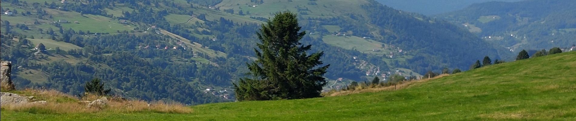
Lac de Lispach, la Roche des Bioquets, La Tête de Grouvelin

oscar1
User
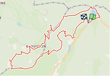

Length
14.9 km

Max alt
1130 m

Uphill gradient
459 m
Km-Effort
21 km

Min alt
866 m

Downhill gradient
458 m
Boucle
Yes
Creation date :
2023-08-18 08:18:58.314
Updated on :
2023-08-18 19:08:31.295
4h46
Difficulty : Medium

FREE GPS app for hiking
 SityTrail
IGN / Geographical institutes
SityTrail Plus
The world is yours!
About
Trail Walking of 14.9 km to be discovered at Grand Est, Vosges, La Bresse. This trail is proposed by oscar1.
Description
Randonnée sans grande difficulté.
Photos


Positioning
Country:
France
Region :
Grand Est
Department/Province :
Vosges
Municipality :
La Bresse
Location:
Unknown
Start:(Dec)
Start:(UTM)
346586 ; 5323988 (32U) N.
Comments