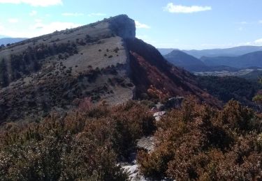
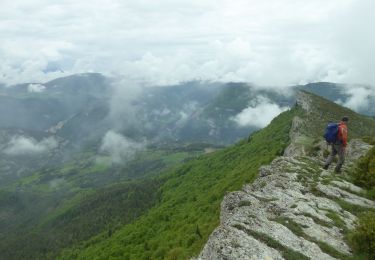
Trail Walking Charens - Montagne de Tarsimoure - Charens  - Photo

Montagne de Tarsimoure - Charens

© OpenStreetMap contributors
Length
Length
13.7 km
Max alt
Max alt
1533 m
Uphill gradient
Uphill gradient
796 m
Km-Effort
Km-Effort  
24 km
Min alt
Min alt
847 m
Downhill gradient
Downhill gradient
792 m
Boucle
Boucle
Yes
Creation date :
2023-08-19 07:11:32.285
Updated on :
2023-08-20 13:40:47.646

(0 Reviews)

Walking
Walking
5h00
Difficulty : Difficult

Scan this QR Code to open this trail in the SityTrail application

FREE GPS app for hiking

Logo SityTrail SityTrail

IGN / Geographical institutes

Download SityTrail from the App Store Download SityTrail from Google Play

Logo SityTrail SityTrail World

The world is yours!

Download SityTrail from the App Store Download SityTrail from Google Play Download SityTrail on Huawei AppGallery

About

Trail Walking of 13.7 km to be discovered at Auvergne-Rhône-Alpes, Drôme, Charens. This trail is proposed by Philindy26.

Description

Départ de Charens, parking Mairie - commune du Haut-Diois (840 m).
Géolocalisation (Google Maps) : https://goo.gl/maps/kFxvXLCEuh7Lid9UA

Monter par les Ranchons (960 m), le hameau des Chitons (966 m), les Moines (995 m) et le Bois Collon pour arriver au col de la Caille (1299m). Passage au Bois Mol (1349 m), puis monter directe sur la Montagne de Tarsimoure par un sentier équipé de câbles.
Suivre les crêtes jusqu'au col de Saint Pierre (1092m) en passant par le point culminant de Tarsimoure (1550 m) et les Cretes de Tarsimoure (1425 m).
Le retour s'effectue par la piste en passant par le Chemin d'Artamare (1050 m), Serre Blanc (936 m), le Réservoir (890 m), Charens (870 m) pour arriver au parking.

Elevation profile

Photos

171 photos in total. Please click on a photo to see them all in the gallery.

Positioning

Country:
France
Region :
Auvergne-Rhône-Alpes
Department/Province :
Drôme
Municipality :
Charens
Location:
Unknown
Start:(UTM)
699360 ; 4934732 (31T) N.

Trails nearby

Trail Mountain bike Charens - Grande Traversée des PréAlpes à VTT : Haut Charens - Valdrôme - Photo
Mountain bike
tracegps

Mountain bike

Difficult
(1)
Charens, Auvergne-Rhône-Alpes, Drôme, France
12.4 km | 18.4 km-effort
1h 45min
No
Trail Walking Charens - montagne de Tarsimoure - Photo
Walking
nadd73

Walking

Medium
Charens, Auvergne-Rhône-Alpes, Drôme, France
13.6 km | 24 km-effort
3h 48min
No
Trail Walking Valdrôme - dindaret peyre grosse valdrome - Photo
Walking
Berrangerannick

Walking

Very easy
Valdrôme, Auvergne-Rhône-Alpes, Drôme, France
11.3 km | 17.5 km-effort
5h 41min
Yes
Trail Walking Charens - F26310 Charens Tarsimoure R2000 - Photo
Walking
ageo

Walking

Difficult
Charens, Auvergne-Rhône-Alpes, Drôme, France
13.7 km | 24 km-effort
4h 53min
Yes
Trail Walking Saint-Dizier-en-Diois - tarsimoure - Photo
Walking
jeanjacquescavet

Walking

Difficult
Saint-Dizier-en-Diois, Auvergne-Rhône-Alpes, Drôme, France
49 km | 104 km-effort
4h 34min
No
Trail Walking Charens - les crêtes de Tarsimoure au départ de Charrens - Photo
Walking
hugo26

Walking

Very difficult
Charens, Auvergne-Rhône-Alpes, Drôme, France
12.9 km | 23 km-effort
5h 16min
Yes
Trail Walking Charens - charens tarsimoure  - Photo
Walking
Joel26400

Walking

Difficult
Charens, Auvergne-Rhône-Alpes, Drôme, France
17.1 km | 29 km-effort
7h 43min
Yes
Trail Walking Charens - Tarsimoure - Photo
Walking
ajd26

Walking

Medium
Charens, Auvergne-Rhône-Alpes, Drôme, France
14.3 km | 25 km-effort
7h 5min
Yes
Trail Cycle Valdrôme - Tour Cyclo Trieve 4 - Photo
Cycle
biollay

Cycle

Medium
Valdrôme, Auvergne-Rhône-Alpes, Drôme, France
36 km | 47 km-effort
2h 40min
No


Close
My subscriptions