


SityTrail - Savoie J1 prévu

danielf
User
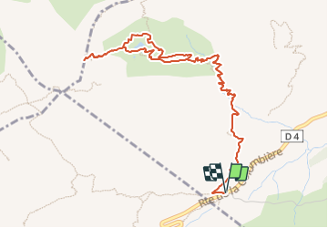

Length
6.6 km

Max alt
2237 m

Uphill gradient
610 m
Km-Effort
14.8 km

Min alt
1614 m

Downhill gradient
611 m
Boucle
Yes
Creation date :
2023-08-23 15:22:49.08
Updated on :
2023-08-23 15:42:08.591
4h28
Difficulty : Difficult

FREE GPS app for hiking
 SityTrail
IGN / Geographical institutes
SityTrail Plus
The world is yours!
About
Trail Walking of 6.6 km to be discovered at Auvergne-Rhône-Alpes, Upper Savoy, Le Reposoir. This trail is proposed by danielf.
Positioning
Country:
France
Region :
Auvergne-Rhône-Alpes
Department/Province :
Upper Savoy
Municipality :
Le Reposoir
Location:
Unknown
Start:(Dec)
Start:(UTM)
304520 ; 5096283 (32T) N.
Comments