


Mont Noir

cmike39
User

Length
2.4 km

Max alt
963 m

Uphill gradient
41 m
Km-Effort
3 km

Min alt
926 m

Downhill gradient
41 m
Boucle
Yes
Creation date :
2023-08-24 07:54:41.185
Updated on :
2023-08-24 08:35:42.099
30m
Difficulty : Easy

FREE GPS app for hiking
 SityTrail
IGN / Geographical institutes
SityTrail Plus
The world is yours!
About
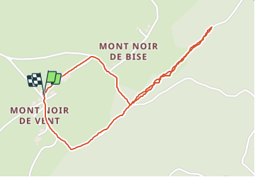
Trail Walking of 2.4 km to be discovered at Bourgogne-Franche-Comté, Jura, Lac-des-Rouges-Truites. This trail is proposed by cmike39.
Positioning
Country:
France
Region :
Bourgogne-Franche-Comté
Department/Province :
Jura
Municipality :
Lac-des-Rouges-Truites
Location:
Unknown
Start:(Dec)
Start:(UTM)
272277 ; 5166761 (32T) N.
Comments