


Lacs des Estaris et col de Prelles

frizou83
User
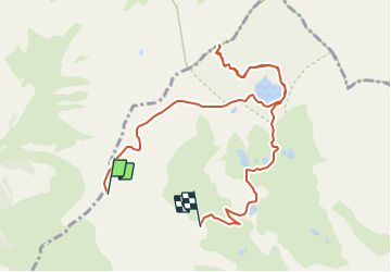

Length
9.7 km

Max alt
2797 m

Uphill gradient
374 m
Km-Effort
15.8 km

Min alt
2284 m

Downhill gradient
710 m
Boucle
No
Creation date :
2023-08-24 15:54:40.637
Updated on :
2023-08-24 15:55:24.995
3h36
Difficulty : Difficult

FREE GPS app for hiking
 SityTrail
IGN / Geographical institutes
SityTrail Plus
The world is yours!
About
Trail Walking of 9.7 km to be discovered at Provence-Alpes-Côte d'Azur, Hautes-Alpes, Orcières. This trail is proposed by frizou83.
Positioning
Country:
France
Region :
Provence-Alpes-Côte d'Azur
Department/Province :
Hautes-Alpes
Municipality :
Orcières
Location:
Unknown
Start:(Dec)
Start:(UTM)
287619 ; 4955477 (32T) N.
Comments