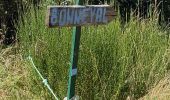
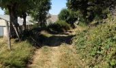
Trail Walking Saint-Chély-d'Aubrac - Compostelle / Chemin du Puy : de Aubrac à Bonneval - Photo

Compostelle / Chemin du Puy : de Aubrac à Bonneval

© OpenStreetMap contributors
Length
Length
33 km
Max alt
Max alt
1321 m
Uphill gradient
Uphill gradient
731 m
Km-Effort
Km-Effort  
46 km
Min alt
Min alt
465 m
Downhill gradient
Downhill gradient
1486 m
Boucle
Boucle
No
Creation date :
2023-08-24 06:05:02.765
Updated on :
2023-08-25 07:11:52.855

(0 Reviews)

Walking
Walking
11h00
Difficulty : Difficult

Scan this QR Code to open this trail in the SityTrail application

FREE GPS app for hiking

Logo SityTrail SityTrail

IGN / Geographical institutes

Download SityTrail from the App Store Download SityTrail from Google Play

Logo SityTrail SityTrail Plus

The world is yours!

Download SityTrail from the App Store Download SityTrail from Google Play Download SityTrail on Huawei AppGallery

About

Trail Walking of 33 km to be discovered at Occitania, Aveyron, Saint-Chély-d'Aubrac. This trail is proposed by webmammuth.

Description

Attention, marche magnifique, mais difficile.
Le gps indique 33,4km en 2D, et 37km en 3D, car 2200m de dénivelé.
Les descentes sont très difficiles, et dangereuses : chaussures fermées, bien serrées, pointure et demie au dessus de votre taille.
Sac allégé si possible (portage à prévoir sur cette rando). D'autant plus qu'un minimum de 2 litres d'eau sera nécessaire à partir de Condom.

Elevation profile

Photos

Positioning

Country:
France
Region :
Occitania
Department/Province :
Aveyron
Municipality :
Saint-Chély-d'Aubrac
Location:
Unknown
Start:(UTM)
498967 ; 4940965 (31T) N.


Close
My subscriptions