


Lac St Cassien

j.burnel
User
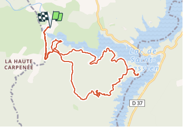

Length
13.1 km

Max alt
321 m

Uphill gradient
318 m
Km-Effort
17.4 km

Min alt
145 m

Downhill gradient
318 m
Boucle
Yes
Creation date :
2023-08-25 08:05:57.863
Updated on :
2023-08-25 14:09:16.191
3h51
Difficulty : Medium

FREE GPS app for hiking
 SityTrail
IGN / Geographical institutes
SityTrail Plus
The world is yours!
About
Trail Walking of 13.1 km to be discovered at Provence-Alpes-Côte d'Azur, Var, Montauroux. This trail is proposed by j.burnel.
Positioning
Country:
France
Region :
Provence-Alpes-Côte d'Azur
Department/Province :
Var
Municipality :
Montauroux
Location:
Unknown
Start:(Dec)
Start:(UTM)
320251 ; 4828568 (32T) N.
Comments