Trail Walking Jouy-le-Moutier - GRP CV-IDF 2023 - Photo
 clalaur
clalaur

User

© OpenStreetMap contributors
Length
Length
15.6 km
Max alt
Max alt
96 m
Uphill gradient
Uphill gradient
164 m
Km-Effort
Km-Effort  
18 km
Min alt
Min alt
18 m
Downhill gradient
Downhill gradient
226 m
Boucle
Boucle
No
Creation date :
2023-08-26 11:48:36.77
Updated on :
2023-11-25 13:10:46.204

(1 Reviews)

Walking
Walking
4h04
Difficulty : Difficult

Scan this QR Code to open this trail in the SityTrail application

FREE GPS app for hiking

Logo SityTrail SityTrail

IGN / Geographical institutes

Download SityTrail from the App Store Download SityTrail from Google Play

Logo SityTrail SityTrail World

The world is yours!

Download SityTrail from the App Store Download SityTrail from Google Play Download SityTrail on Huawei AppGallery

About

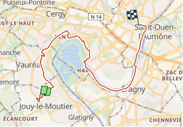
Trail Walking of 15.6 km to be discovered at Ile-de-France, Val-d'Oise, Jouy-le-Moutier. This trail is proposed by clalaur.

Description

Rando faite le dans la journée du vendredi 24 novembre 2023.
Départ : Arrêt Les Tremblays (Bus STIVO 34) ; Arrivée : Gare de Pontoise (RER C ; Train H et J)

Elevation profile

Photos

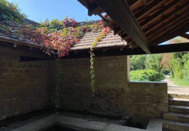
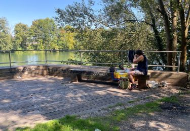
21 photos in total. Please click on a photo to see them all in the gallery.

Positioning

Country:
France
Region :
Ile-de-France
Department/Province :
Val-d'Oise
Municipality :
Jouy-le-Moutier
Location:
Unknown
Start:(UTM)
428892 ; 5429407 (31U) N.

Comments

Please log in to post a review or rate the element


Trails nearby

Trail Walking Pontoise - GRP CV-IDF 2023 - Photo
Walking
clalaur

Walking

Difficult
(1)
Pontoise, Ile-de-France, Val-d'Oise, France
15.3 km | 18.6 km-effort
4h 13min
No
Trail Running Cergy - Les Bords de l'Oise et la Passerelle de l'Axe Majeur - Port Cergy - Photo
Running
tracegps

Running

Easy
(1)
Cergy, Ile-de-France, Val-d'Oise, France
5.2 km | 5.8 km-effort
30min
Yes
Trail On foot Cergy - LES BALADES DE L’ÉTÉ # 9 / DE L’AXE MAJEUR À PORT CERGY - Photo
On foot
Vadim

On foot

Very easy
(1)
Cergy, Ile-de-France, Val-d'Oise, France
6 km | 7.4 km-effort
1h 45min
Yes
Trail On foot Cergy - Le Fil d'Ariane - Photo
On foot
PRO

On foot

Easy
Cergy, Ile-de-France, Val-d'Oise, France
3.2 km | 3.7 km-effort
50min
No
Trail Mountain bike Vernouillet - Activity - Photo
Mountain bike
louisgef

Mountain bike

Very difficult
(1)
Vernouillet, Ile-de-France, Yvelines, France
44 km | 51 km-effort
3h 33min
Yes
Trail On foot Cergy - Bords d'Oise Eragny - Port Cergy - Photo
On foot
Vadim

On foot

Very easy
(1)
Cergy, Ile-de-France, Val-d'Oise, France
8 km | 8.7 km-effort
2h 0min
Yes
Trail Walking Neuville-sur-Oise - base losir cergy  - Photo
Walking
bertrandgeffroy

Walking

Medium
(1)
Neuville-sur-Oise, Ile-de-France, Val-d'Oise, France
22 km | 26 km-effort
5h 35min
No
Trail On foot Conflans-Sainte-Honorine - Conflans fin d'oise - Andresy - La Frette - Photo
On foot
chessyca

On foot

Medium
Conflans-Sainte-Honorine, Ile-de-France, Yvelines, France
22 km | 27 km-effort
6h 14min
No
Trail Walking Triel-sur-Seine - le tour du Grand Paris via le GR1 - Etape 3 Triels sur Seine - Santeuil - Photo
Walking
chessyca

Walking

Medium
Triel-sur-Seine, Ile-de-France, Yvelines, France
31 km | 38 km-effort
6h 27min
No


Close
My subscriptions