


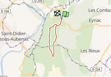
Jastres

pb07
User

Length
4.1 km

Max alt
320 m

Uphill gradient
33 m
Km-Effort
4.5 km

Min alt
301 m

Downhill gradient
35 m
Boucle
Yes
Creation date :
2023-09-02 15:00:07.667
Updated on :
2023-09-02 16:53:56.45
1h03
Difficulty : Easy

FREE GPS app for hiking
 SityTrail
IGN / Geographical institutes
SityTrail Plus
The world is yours!
About
Trail Walking of 4.1 km to be discovered at Auvergne-Rhône-Alpes, Ardèche, Lussas. This trail is proposed by pb07.
Positioning
Country:
France
Region :
Auvergne-Rhône-Alpes
Department/Province :
Ardèche
Municipality :
Lussas
Location:
Unknown
Start:(Dec)
Start:(UTM)
614334 ; 4941048 (31T) N.
Comments