


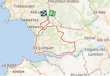
Trébeurden - Croaz Golo GR34A GR34 - 15.1km 320m 4h15 (50mn) - 2023 09 03

Orcal37
User GUIDE


4h15
Difficulty : Medium

FREE GPS app for hiking
 SityTrail
IGN / Geographical institutes
SityTrail Plus
The world is yours!
About
Trail Walking of 15.1 km to be discovered at Brittany, Côtes-d'Armor, Trébeurden. This trail is proposed by Orcal37.
Description
Trébeurden - Croaz Golo - Chapelle Saint-Thurien - GR34 - Chemin de Halage du Léguer - Forn ar Ra - Pointe Servel - Plage de Mez an Aod - Pointe de Beg Léguer - Plage de Goas Lagorn - PR - 15.1km 320m 4h15 (50mn) - 2023 09 03
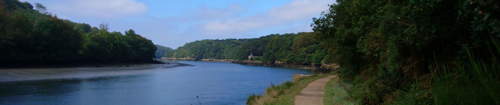
Photos
 - 2023 09 03 - Photo 1")
 - 2023 09 03 - Photo 2")
 - 2023 09 03 - Photo 3")
 - 2023 09 03 - Photo 4")
 - 2023 09 03 - Photo 5")
 - 2023 09 03 - Photo 6")
 - 2023 09 03 - Photo 7")
 - 2023 09 03 - Photo 8")
 - 2023 09 03 - Photo 9")
 - 2023 09 03 - Photo 10")
Positioning
Comments