


St Chely

cmike39
User
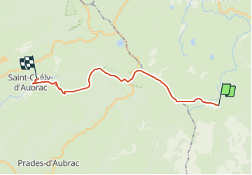

Length
21 km

Max alt
1415 m

Uphill gradient
229 m
Km-Effort
25 km

Min alt
808 m

Downhill gradient
755 m
Boucle
No
Creation date :
2023-09-03 07:03:39.942
Updated on :
2023-09-03 15:44:00.621
4h25
Difficulty : Very difficult

FREE GPS app for hiking
 SityTrail
IGN / Geographical institutes
SityTrail Plus
The world is yours!
About
Trail Walking of 21 km to be discovered at Occitania, Lozère, Les Salces. This trail is proposed by cmike39.
Positioning
Country:
France
Region :
Occitania
Department/Province :
Lozère
Municipality :
Les Salces
Location:
Unknown
Start:(Dec)
Start:(UTM)
508467 ; 4935620 (31T) N.
Comments