


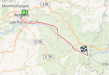
Angers-Montsoreau

patrando49
User

Length
64 km

Max alt
47 m

Uphill gradient
401 m
Km-Effort
70 km

Min alt
14 m

Downhill gradient
392 m
Boucle
No
Creation date :
2023-09-04 11:07:38.994
Updated on :
2023-09-04 11:31:56.349
4h13
Difficulty : Very difficult

FREE GPS app for hiking
 SityTrail
IGN / Geographical institutes
SityTrail Plus
The world is yours!
About
Trail Road bike of 64 km to be discovered at Pays de la Loire, Maine-et-Loire, Angers. This trail is proposed by patrando49.
Positioning
Country:
France
Region :
Pays de la Loire
Department/Province :
Maine-et-Loire
Municipality :
Angers
Location:
Unknown
Start:(Dec)
Start:(UTM)
683998 ; 5257548 (30T) N.
Comments