


Chartreuse Grand Som col Cucheron

c.gourme
User

Length
11.1 km

Max alt
2014 m

Uphill gradient
907 m
Km-Effort
23 km

Min alt
1147 m

Downhill gradient
906 m
Boucle
Yes
Creation date :
2023-09-03 07:32:48.0
Updated on :
2023-09-04 12:53:59.74
6h02
Difficulty : Medium

FREE GPS app for hiking
 SityTrail
IGN / Geographical institutes
SityTrail Plus
The world is yours!
About
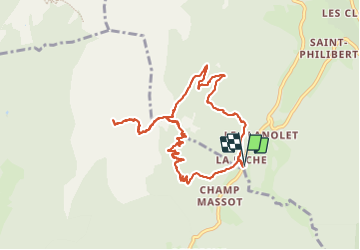
Trail Walking of 11.1 km to be discovered at Auvergne-Rhône-Alpes, Isère, Saint-Pierre-d'Entremont. This trail is proposed by c.gourme.
Description
Boucle très agréable à partir du col des Aures
Positioning
Country:
France
Region :
Auvergne-Rhône-Alpes
Department/Province :
Isère
Municipality :
Saint-Pierre-d'Entremont
Location:
Unknown
Start:(Dec)
Start:(UTM)
721950 ; 5027470 (31T) N.
Comments