Trail Walking Vinadio - Bagni Vinadio J1 à Refuge Mogliorero par P26 - Photo

Bagni Vinadio J1 à Refuge Mogliorero par P26

 MAD-CVW
MAD-CVW

User

© OpenStreetMap contributors
Length
Length
14.5 km
Max alt
Max alt
2025 m
Uphill gradient
Uphill gradient
788 m
Km-Effort
Km-Effort  
25 km
Min alt
Min alt
1278 m
Downhill gradient
Downhill gradient
790 m
Boucle
Boucle
Yes
Creation date :
2023-09-04 05:29:25.472
Updated on :
2023-09-04 15:24:02.963

(0 Reviews)

Walking
Walking
5h11
Difficulty : Very difficult

Scan this QR Code to open this trail in the SityTrail application

FREE GPS app for hiking

Logo SityTrail SityTrail

IGN / Geographical institutes

Download SityTrail from the App Store Download SityTrail from Google Play

Logo SityTrail SityTrail World

The world is yours!

Download SityTrail from the App Store Download SityTrail from Google Play Download SityTrail on Huawei AppGallery

About

Trail Walking of 14.5 km to be discovered at Piemont, Cuneo, Vinadio. This trail is proposed by MAD-CVW.

Description

départ de Bagni en montant l'itinéraire P26 balisé rouge-blanc, a droite de l'église sur beau sentier prenant rapidement de l'altitude. passage dans le village de Besmorello aux maisons typiques, puis le sentier progresse par des prairies jusqu'au hameau de Luca a 1542m. Sculptures en tôle de Loulou.
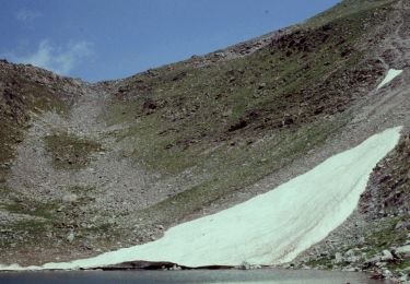
Prendre le chemin à gauche pour monter par la rive droite du torrent Ischiator et rejoindre le sentier vers le refuge en laissant le chemin carrossable sur la droite. Traverser un pont, le sentier monte rive gauche jusqu'à une très belle cascade a 1800m, puis monté agréable jusqu'au bas du refuge
Retour par même chemin avec variante par Strada rive gauche jusqu'à Besmorello, puis sentier descendant à Bagni.

Elevation profile

Positioning

Country:
Italy
Region :
Piemont
Department/Province :
Cuneo
Municipality :
Vinadio
Location:
Unknown
Start:(UTM)
346469 ; 4905786 (32T) N.

Trails nearby

Trail On foot Vinadio - Alte Valli - Tappa 02 - Photo
On foot
PRO

On foot

Easy
Vinadio, Piemont, Cuneo, Italy
8.5 km | 18.5 km-effort
4h 12min
No
Trail On foot Vinadio - (SI E14) Vinadio Frazione Strepeis - Sambuco - Photo
On foot
PRO

On foot

Medium
Vinadio, Piemont, Cuneo, Italy
10.9 km | 25 km-effort
5h 43min
No
Trail On foot Vinadio - San Bernolfo-Corborant - Photo
On foot
PRO

On foot

Easy
Vinadio, Piemont, Cuneo, Italy
5.8 km | 14.9 km-effort
3h 23min
No
Trail On foot Vinadio - IT-P49 - Photo
On foot
PRO

On foot

Easy
Vinadio, Piemont, Cuneo, Italy
6.2 km | 10.3 km-effort
2h 20min
No
Trail On foot Pietraporzio - IT-P48 - Photo
On foot
PRO

On foot

Easy
Pietraporzio, Piemont, Cuneo, Italy
4.8 km | 10.5 km-effort
2h 23min
No
Trail On foot Vinadio - Alte Valli - Tappa 01 - Photo
On foot
PRO

On foot

Easy
Vinadio, Piemont, Cuneo, Italy
6 km | 10.2 km-effort
2h 18min
No
Trail On foot Vinadio - San Bernolfo-Testa dell'Autaret - Photo
On foot
PRO

On foot

Easy
Vinadio, Piemont, Cuneo, Italy
7 km | 18.4 km-effort
4h 10min
No
Trail Walking Vinadio - J3-Vallon Tesina - Passo Sometta - Vallon Sauma - Photo
Walking
MAD-CVW

Walking

Very difficult
Vinadio, Piemont, Cuneo, Italy
32 km | 45 km-effort
4h 2min
No
Trail Walking Vinadio - J4-Bernolfo - Lago Lausfer - Photo
Walking
MAD-CVW

Walking

Very difficult
Vinadio, Piemont, Cuneo, Italy
32 km | 45 km-effort
27h 25min
No


Close
My subscriptions