


les rapides de la Malbaie

aldaus
User
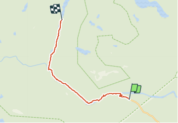

Length
9.5 km

Max alt
256 m

Uphill gradient
99 m
Km-Effort
10.8 km

Min alt
212 m

Downhill gradient
83 m
Boucle
No
Creation date :
2023-09-04 15:33:43.419
Updated on :
2023-09-06 01:03:51.359
2h45
Difficulty : Medium

FREE GPS app for hiking
 SityTrail
IGN / Geographical institutes
SityTrail Plus
The world is yours!
About
Trail Walking of 9.5 km to be discovered at Quebec, Charlevoix-Est, Mont-Élie. This trail is proposed by aldaus.
Description
attention, le sentier longe la route....il y a sûrement plus sauvage au Québec !!!
Positioning
Country:
Canada
Region :
Quebec
Department/Province :
Charlevoix-Est
Municipality :
Mont-Élie
Location:
Unknown
Start:(Dec)
Start:(UTM)
393075 ; 5301126 (19T) N.
Comments