


mont du lac des cygnes

aldaus
User
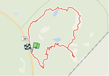

Length
12.1 km

Max alt
966 m

Uphill gradient
599 m
Km-Effort
20 km

Min alt
524 m

Downhill gradient
603 m
Boucle
Yes
Creation date :
2023-09-05 13:55:07.274
Updated on :
2023-09-06 01:03:53.827
5h08
Difficulty : Medium

FREE GPS app for hiking
 SityTrail
IGN / Geographical institutes
SityTrail Plus
The world is yours!
About
Trail Walking of 12.1 km to be discovered at Quebec, Charlevoix, Lac-Pikauba. This trail is proposed by aldaus.
Positioning
Country:
Canada
Region :
Quebec
Department/Province :
Charlevoix
Municipality :
Lac-Pikauba
Location:
Unknown
Start:(Dec)
Start:(UTM)
377844 ; 5280602 (19T) N.
Comments