Trail Walking Mayres-Savel - Mayres..La Beauté 250 + - Photo

Mayres..La Beauté 250 +

© OpenStreetMap contributors
Length
Length
8.3 km
Max alt
Max alt
767 m
Uphill gradient
Uphill gradient
248 m
Km-Effort
Km-Effort  
11.6 km
Min alt
Min alt
583 m
Downhill gradient
Downhill gradient
248 m
Boucle
Boucle
Yes
Creation date :
2023-09-06 06:03:39.288
Updated on :
2023-09-06 08:59:50.376

(0 Reviews)

Walking
Walking
2h55
Difficulty : Medium

Scan this QR Code to open this trail in the SityTrail application

FREE GPS app for hiking

Logo SityTrail SityTrail

IGN / Geographical institutes

Download SityTrail from the App Store Download SityTrail from Google Play

Logo SityTrail SityTrail World

The world is yours!

Download SityTrail from the App Store Download SityTrail from Google Play Download SityTrail on Huawei AppGallery

About

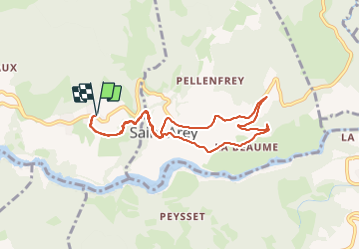
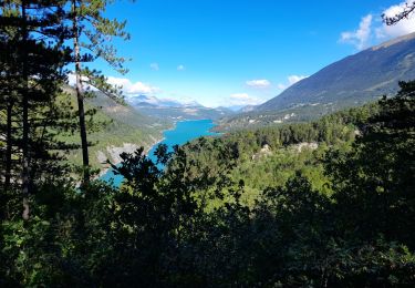
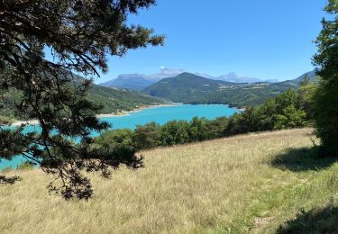
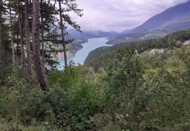
Trail Walking of 8.3 km to be discovered at Auvergne-Rhône-Alpes, Isère, Mayres-Savel. This trail is proposed by claude nier.

Description

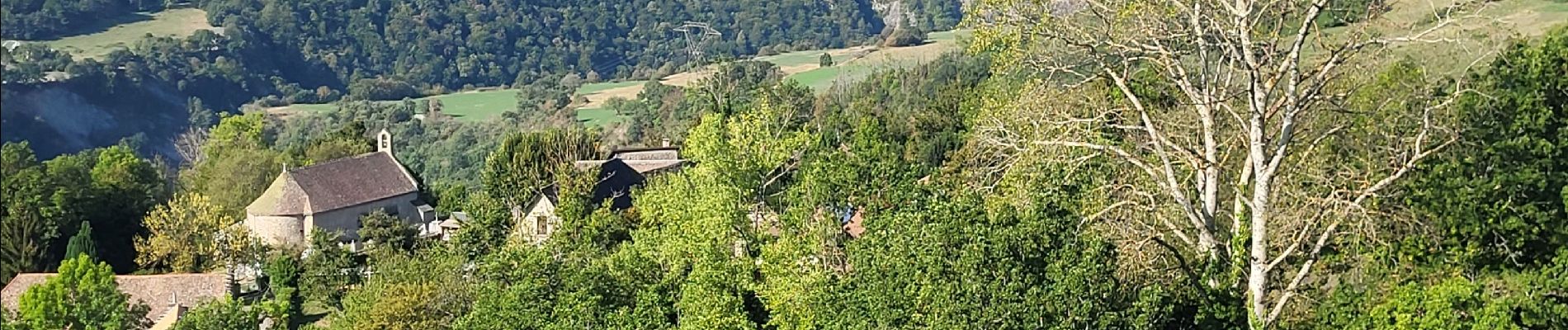
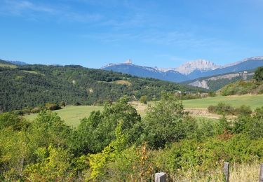
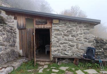
Rando du matin ,re-découvrir de mon pays...Bonheur

Elevation profile

Photos

Positioning

Country:
France
Region :
Auvergne-Rhône-Alpes
Department/Province :
Isère
Municipality :
Mayres-Savel
Location:
Unknown
Start:(UTM)
715064 ; 4972598 (31T) N.

Trails nearby

Trail Road bike La Mure - La Mure les 4 lacs - Photo
Road bike
Uio73

Road bike

Medium
(1)
La Mure, Auvergne-Rhône-Alpes, Isère, France
58 km | 72 km-effort
4h 22min
Yes
Trail Walking Mayres-Savel - Passerelles Hymalayene  Mayres + 250 - Photo
Walking
claude nier

Walking

Medium
Mayres-Savel, Auvergne-Rhône-Alpes, Isère, France
4.9 km | 8.2 km-effort
1h 59min
Yes
Trail Walking Susville - Susville les Merlins boucle par le col du Sénépiy - Photo
Walking
gmtrando

Walking

Medium
Susville, Auvergne-Rhône-Alpes, Isère, France
10.1 km | 16.3 km-effort
3h 30min
Yes
Trail Walking Treffort - ISERE: MONTEYNARD PASSERELLES HIMALAYENNES  - Photo
Walking
djeepee74

Walking

Medium
Treffort, Auvergne-Rhône-Alpes, Isère, France
16.1 km | 22 km-effort
3h 52min
Yes
Trail Walking Mayres-Savel - Randonnée des passerelles  - Photo
Walking
choubaka77

Walking

Easy
Mayres-Savel, Auvergne-Rhône-Alpes, Isère, France
11.9 km | 17.9 km-effort
4h 51min
No
Trail Trail Prunières - Trail du 3ème Poste  - Photo
Trail
phd04

Trail

Medium
Prunières, Auvergne-Rhône-Alpes, Isère, France
17.7 km | 28 km-effort
2h 33min
No
Trail Walking Treffort - Valgo2 - J3. : les passerelles de Monteynard - Photo
Walking
ETMU5496

Walking

Easy
Treffort, Auvergne-Rhône-Alpes, Isère, France
12.4 km | 18.6 km-effort
2h 42min
No
Trail Walking Treffort - Les deux passerelles Drac et Ebron - Photo
Walking
zazie

Walking

Medium
Treffort, Auvergne-Rhône-Alpes, Isère, France
15.8 km | 25 km-effort
3h 23min
Yes
Trail Walking Mayres-Savel - Passerelles  Du Drac Et de L'Ebron - Photo
Walking
donda

Walking

Easy
Mayres-Savel, Auvergne-Rhône-Alpes, Isère, France
12.2 km | 18.4 km-effort
3h 13min
No


Close
My subscriptions