


sjc05

erisel
User
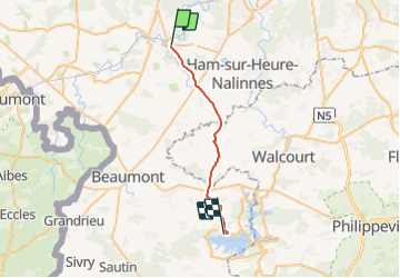

Length
21 km

Max alt
272 m

Uphill gradient
265 m
Km-Effort
24 km

Min alt
145 m

Downhill gradient
186 m
Boucle
No
Creation date :
2023-09-06 17:27:48.164
Updated on :
2023-09-06 17:28:27.891
5h27
Difficulty : Medium

FREE GPS app for hiking
 SityTrail
IGN / Geographical institutes
SityTrail Plus
The world is yours!
About
Trail On foot of 21 km to be discovered at Wallonia, Hainaut, Thuin. This trail is proposed by erisel.
Positioning
Country:
Belgium
Region :
Wallonia
Department/Province :
Hainaut
Municipality :
Thuin
Location:
Unknown
Start:(Dec)
Start:(UTM)
591967 ; 5577268 (31U) N.
Comments