


26 Font d'Urle

ericf64
User
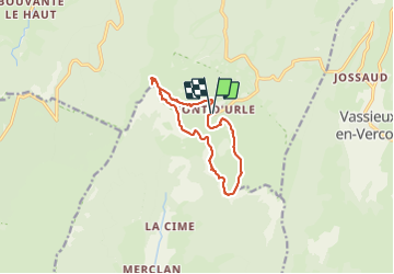

Length
10.5 km

Max alt
1691 m

Uphill gradient
478 m
Km-Effort
16.9 km

Min alt
1430 m

Downhill gradient
478 m
Boucle
Yes
Creation date :
2023-09-07 06:16:21.664
Updated on :
2023-09-07 09:40:58.53
3h23
Difficulty : Medium

FREE GPS app for hiking
 SityTrail
IGN / Geographical institutes
SityTrail Plus
The world is yours!
About
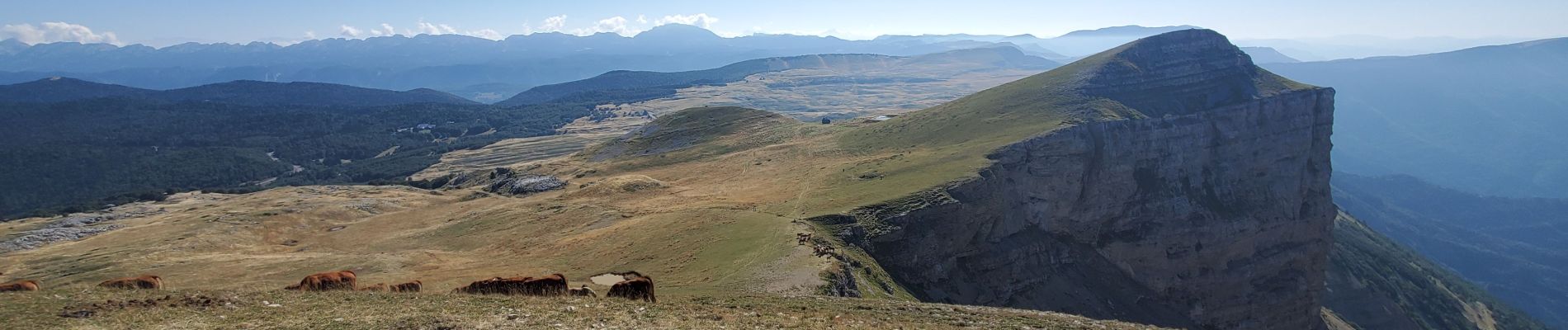
Trail Walking of 10.5 km to be discovered at Auvergne-Rhône-Alpes, Drôme, Bouvante. This trail is proposed by ericf64.
Photos


Positioning
Country:
France
Region :
Auvergne-Rhône-Alpes
Department/Province :
Drôme
Municipality :
Bouvante
Location:
Unknown
Start:(Dec)
Start:(UTM)
683248 ; 4974247 (31T) N.
Comments