


20230907 Lisors Mortemer

Childebert
User
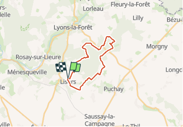

Length
21 km

Max alt
194 m

Uphill gradient
358 m
Km-Effort
26 km

Min alt
71 m

Downhill gradient
359 m
Boucle
Yes
Creation date :
2023-09-07 07:24:18.599
Updated on :
2023-09-07 20:43:03.491
5h54
Difficulty : Very difficult

FREE GPS app for hiking
 SityTrail
IGN / Geographical institutes
SityTrail Plus
The world is yours!
About
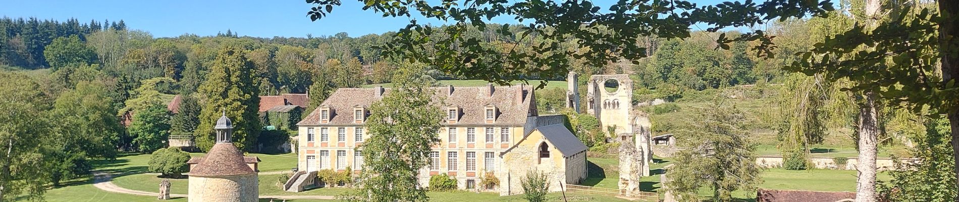
Trail Walking of 21 km to be discovered at Normandy, Eure, Lisors. This trail is proposed by Childebert.
Photos


Positioning
Country:
France
Region :
Normandy
Department/Province :
Eure
Municipality :
Lisors
Location:
Unknown
Start:(Dec)
Start:(UTM)
388917 ; 5467925 (31U) N.
Comments