


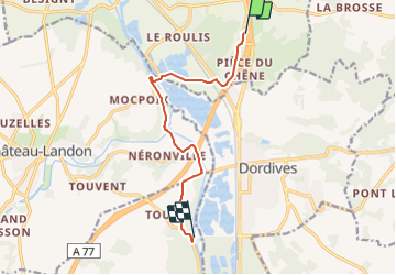
Du Loing aux sources de l’Ouanne (Track)

olivieraron
User

Length
8.7 km

Max alt
107 m

Uphill gradient
89 m
Km-Effort
10 km

Min alt
64 m

Downhill gradient
120 m
Boucle
No
Creation date :
2023-09-08 04:49:28.191
Updated on :
2023-09-08 04:51:55.631
1h00
Difficulty : Very easy

FREE GPS app for hiking
 SityTrail
IGN / Geographical institutes
SityTrail Plus
The world is yours!
About
Trail Car of 8.7 km to be discovered at Ile-de-France, Seine-et-Marne, Souppes-sur-Loing. This trail is proposed by olivieraron.


Positioning
Country:
France
Region :
Ile-de-France
Department/Province :
Seine-et-Marne
Municipality :
Souppes-sur-Loing
Location:
Unknown
Start:(Dec)
Start:(UTM)
482581 ; 5335761 (31U) N.
Comments