


Pont du Countet lac Niré

taguette
User
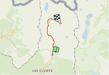

Length
7.1 km

Max alt
2377 m

Uphill gradient
710 m
Km-Effort
14.3 km

Min alt
1686 m

Downhill gradient
28 m
Boucle
No
Creation date :
2023-09-04 07:30:13.011
Updated on :
2023-09-08 17:45:00.766
3h39
Difficulty : Difficult

FREE GPS app for hiking
 SityTrail
IGN / Geographical institutes
SityTrail Plus
The world is yours!
About
Trail Walking of 7.1 km to be discovered at Provence-Alpes-Côte d'Azur, Maritime Alps, Belvédère. This trail is proposed by taguette.
Positioning
Country:
France
Region :
Provence-Alpes-Côte d'Azur
Department/Province :
Maritime Alps
Municipality :
Belvédère
Location:
Unknown
Start:(Dec)
Start:(UTM)
371937 ; 4881354 (32T) N.
Comments